Sustainable Urban Planning: Using Data to Create Greener Cities
In an increasingly urbanized world, the challenges of balancing growth and sustainability have never been more pressing. The rapid expansion of cities brings with it the urgent need to address issues such as resource scarcity, pollution, and quality of life. Fortunately, the intersection of urban planning and data science is providing a pathway toward building greener, more sustainable cities. In this blog post, we will explore how data-driven approaches are revolutionizing urban planning to create environmentally friendly and livable urban environments.
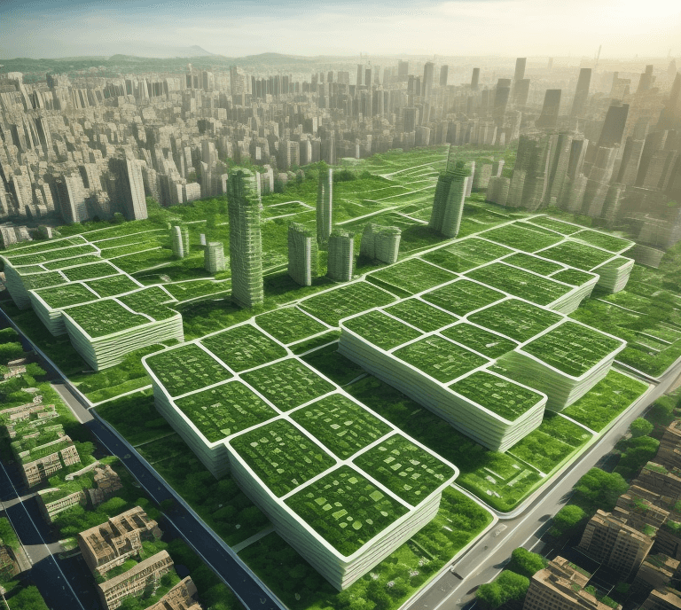
Figure 1. An ilustration of possible urban design obtained by data-driven approaches.
Traditional urban planning relied heavily on intuition and historical precedents, often leading to unforeseen consequences. Today, the proliferation of data sources—ranging from satellite imagery and sensor networks to social media interactions—has opened up new avenues for understanding urban dynamics in real time. By harnessing the power of big data and advanced analytics, urban planners can make informed decisions that mitigate the negative impacts of urbanization. One of the key challenges in urban sustainability is the efficient allocation of limited resources such as water, energy, and land. Data-driven models can simulate resource usage patterns, enabling planners to identify optimal locations for essential infrastructure, like water treatment plants and renewable energy installations. This proactive approach minimizes waste and environmental degradation, making cities more resilient to future challenges. For instance, air pollution is a critical issue in many urban areas, with detrimental effects on public health and the environment. Data from sensors, satellite imagery, and weather forecasts can provide real-time insights into pollution levels and the movement of air masses. By analyzing this data, urban planners can design green spaces, cycling lanes, and pedestrian-friendly zones strategically to improve air quality and encourage eco-friendly transportation.
Since the subject is extrimaly broad, and each task requires a dedicated expertise, there is not enough space in this post to cover it all. Hence, for the curious reader, here are three short representing cases for using data-driven methods in urban planning.
Example 1: Predictive Water Demand Modeling
By integrating historical usage data, weather forecasts, and socioeconomic variables, predictive models such as ARIMA or machine learning algorithms like XGBoost can anticipate water demand fluctuations across various urban zones. This allows for proactive allocation of resources, facilitating the implementation of demand-based pricing strategies, and aiding the placement of smart water distribution networks to curtail waste.
Example 2: Optimized Waste Collection via IoT Sensors
Deploying Internet of Things (IoT) sensors within waste bins, leveraging technologies like LoRaWAN or NB-IoT, enables continuous monitoring of fill levels. Data aggregated from these sensors, processed using edge computing or cloud platforms, fuels route optimization algorithms based on vehicle capacity, traffic conditions, and collection frequency. Consequently, waste collection becomes demand-driven, curtailing unnecessary trips, conserving fuel, and minimizing the carbon footprint.
Example 3: Dynamic Traffic Pattern Analysis
Utilizing real-time traffic data from sources such as GPS probes, road sensors, and crowd-sourced applications, traffic pattern analyses employing techniques like cluster analysis and neural networks can discern congestion hotspots and peak travel times. This information empowers the implementation of dynamic traffic management strategies through variable message signs and adaptive traffic signal control, ultimately reducing vehicular emissions and air pollution.
The convergence of technical expertise and urban planning wisdom holds the promise of reshaping the urban landscape for a more sustainable future. Aspiring students and researchers interested in this interdisciplinary field have ample opportunities for future investigations. Exploring advanced predictive modeling techniques, such as deep learning and reinforcement learning, to forecast complex urban dynamics could yield more accurate resource allocation strategies. Moreover, the fusion of data from disparate sources, such as satellite imagery and social media data, can unlock insights into broader urban behavior patterns. The application of blockchain technology to enhance transparency and trust in smart city infrastructure is another avenue ripe for exploration. By embracing the challenges of sustainable urban planning, future researchers can contribute to a world where cities not only thrive but also exemplify harmony with their environment.